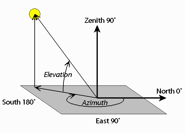
Azimuth and Elevation are measures used to identify the position of a satellite flying overhead. Azimuth tells you what direction to face and Elevation tells you how high up in the sky to look. Both are measured in degrees. Azimuth varies from 0° to 360°. It starts with North at 0°. As you turn to your right (in a clockwise direction) you'll face East (which is 90°), then South (which is 180°), then West (which is 270°), and then return to North (which is 360° and also 0°). So if the Azimuth for your satellite is, say, 45°, that means your satellite is northeast of you. Elevation is also measured in degrees. A satellite just barely rising over your horizon would be at 0° Elevation, and a satellite directly overhead would be at 90° Elevation (a.k.a., "the zenith").
In the diagram below, the yellow circle represents the satellite. It has an Azimuth of about 200° (southwest of the observer) and an Elevation of about 60° (about 2/3 of the way up in the sky).
So on the Celestis Satellite Tracking webpage, "START AZIMUTH" tells you what direction the satellite will rise over one horizon in your sky, "MAX ELEVATION" tells you the maximum height the satellite will fly in your sky, and "END AZIMUTH" tells you what direction the satellite will set over another horizon in your sky.
Note: It is our responsibility to protect your privacy and we guarantee that your email address will be completely confidential. × Close